

10 Best Hikes on Mount Baker Highway in Washington’s North Cascades

The North Cascades in Washington State are my absolute favorite mountains to hike in and many of my favorite trails are accessed via Mount Baker Highway. In this post, I’m sharing the best day hikes off Mount Baker Highway – from lush mossy forests to alpine lakes and dramatic mountain views.
Whether you're looking for an easy trail or a challenging all-day hike, this guide includes the best easy, moderate, and hard hikes on Highway 542 (Mount Baker Highway).
Table of Contents:
Let’s Connect: Instagram • TikTok • YouTube • Join My Newsletter | Enjoy This Post? Ways to Support this Blog
Affiliate Disclosure: This blog post contains affiliate links, which means that if you click on a link and make a purchase, I receive a small percentage at no additional cost to you. This helps me continue to provide free resources for you! Thank you so much for supporting my work and helping me keep these resources available. You can read more about my affiliate policy here.
Leave No Trace
When spending time outdoors, especially in fragile alpine environments like those off Mount Baker Highway, it's essential to Leave No Trace. These seven principles help protect our trails, wildlife, and wild places:
Plan Ahead & Prepare
Travel & Camp on Durable Surfaces
Dispose of Waste Properly
Leave What You Find
Minimize Campfire Impacts
Respect Wildlife
Be Considerate of Others
What to Bring on a Day Hike
Wondering what to bring on a day hike? I wrote an entire blog on Day Hiking Essentials: What to Wear and Bring on a Day Hike! Here’s a very brief overview of what I like to bring on day hikes (read the full blog post for more details!):
Gear:
Water and Water Bottle
Food & Snacks
Navigation Tools: AllTrails, Paper Maps, Compass
Sunscreen and Sunglasses
Trekking Poles - these are important to have if there are river crossings!
Microspikes - good to have if there is still snow on the trail
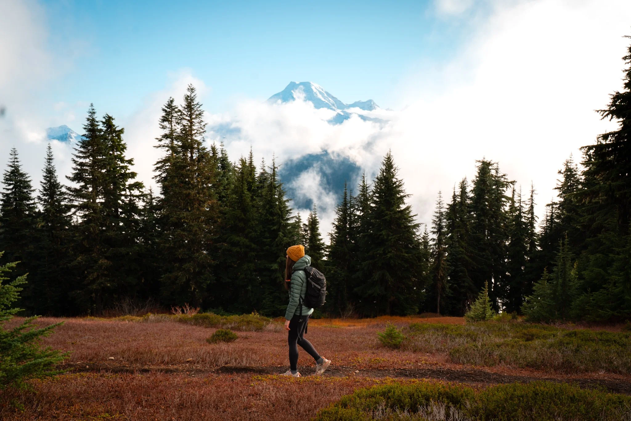
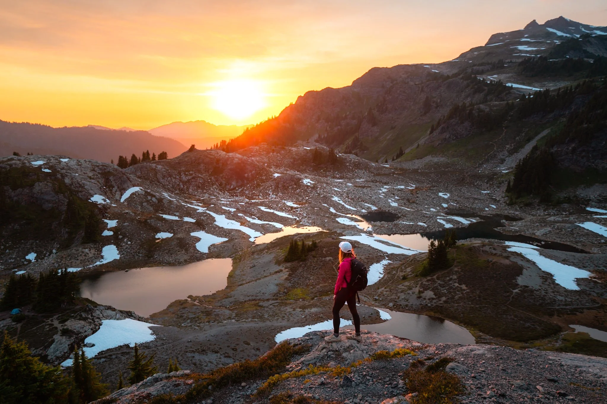
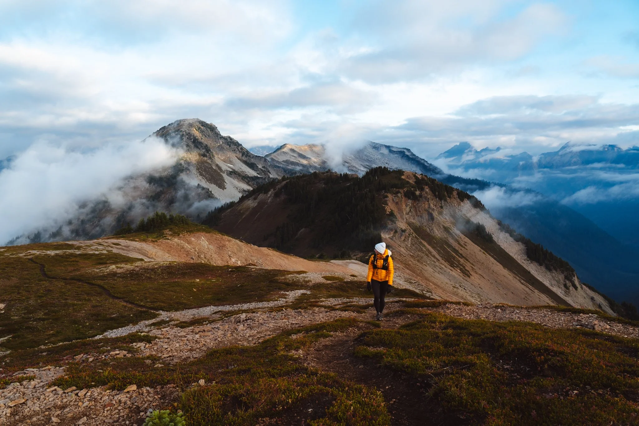
Best Hikes on Mount Baker Highway
Easy Hikes
Picture Lake Path
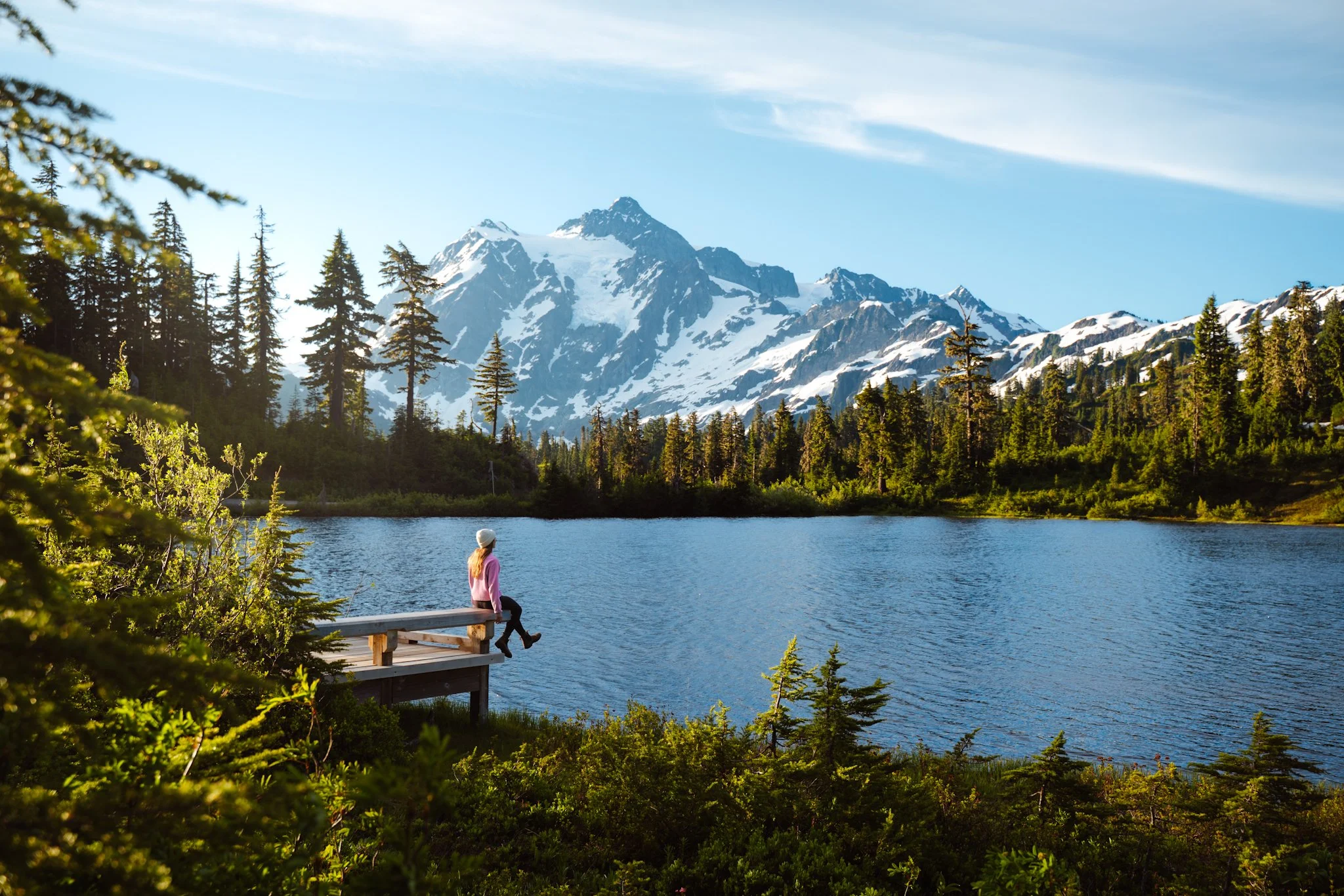
Picture Lake with view of Mount Shuksan off of Mount Baker Highway
Distance: 0.6 miles roundtrip
Difficulty: Easy
Elevation Gain: 45 ft
Best Time to Hike: Late June through October. Snow usually melts out by late June.
Route Type: Loop
Highest Point: 4,157 ft
Dogs Allowed? Yes, must be on a leash.
Permit/Parking Pass/Fee Required: Northwest Forest Pass or the America the Beautiful Interagency Pass
Trailhead/Parking: Picture Lake Parking Area
Trail Guide: AllTrails / Washington Trails Association
Road Condition: Paved all the way to the trailhead. 2x2 accessible.
This is easily one of the best views in Washington State and it’s right off the side of the road! Picture Lake Path is an ADA-accessible trail that loops around Picture Lake. When the water is still, the lake offers a stunning reflection of Mount Shuksan.
Horseshoe Bend
Distance: 3 miles roundtrip
Difficulty: Easy
Elevation Gain: 459 ft
Best Time to Hike: Year-round
Route Type: Out-and-back
Highest Point: 1,200 ft
Dogs Allowed? Yes, must be on a leash.
Permit/Parking Pass/Fee Required: Northwest Forest Pass or the America the Beautiful Interagency Pass
Trailhead/Parking: Horseshoe Bend Trailhead
Trail Guide: AllTrails / Washington Trails Association
Road Condition: Paved all the way to the trailhead. 2x2 accessible.
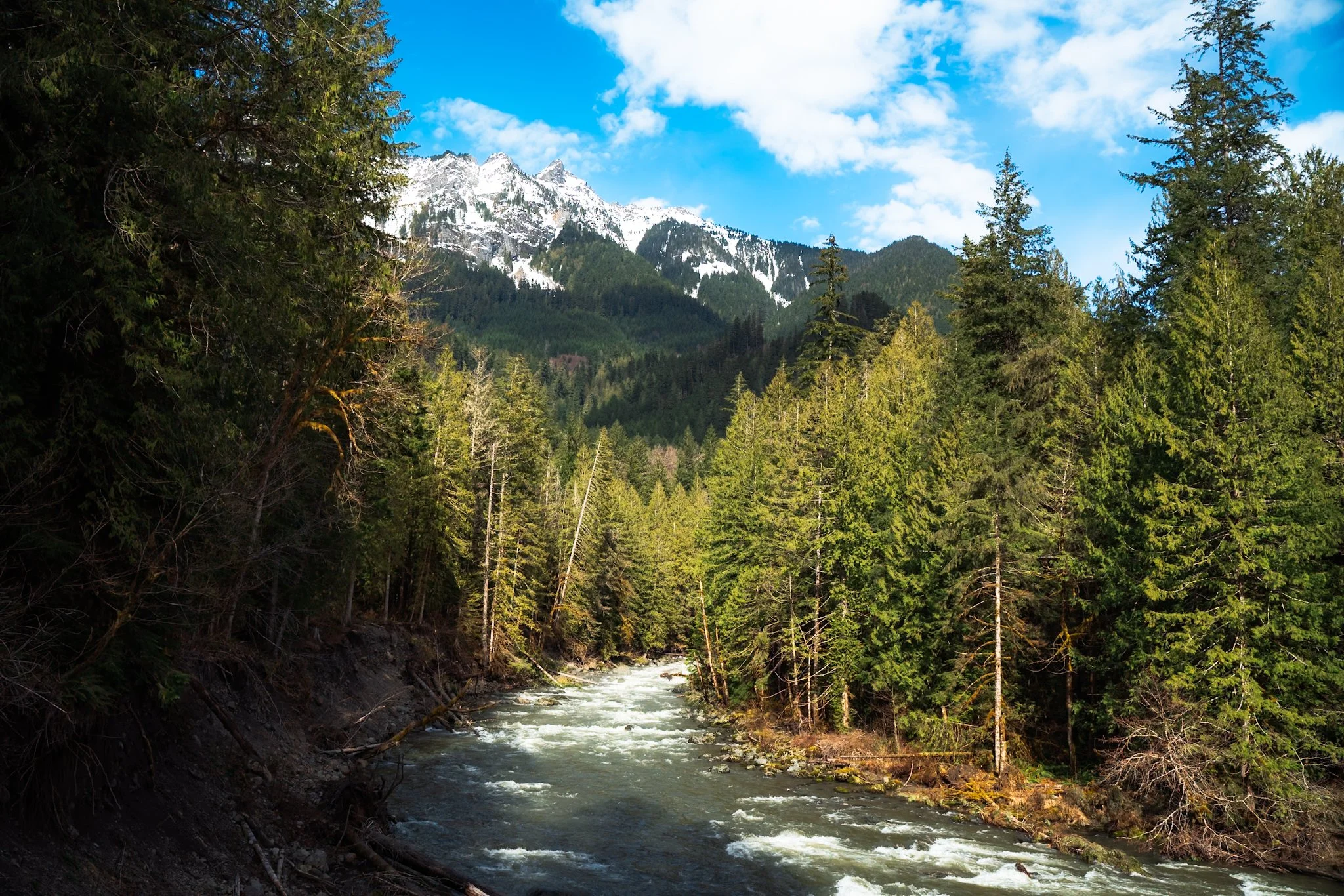
Horseshoe Bend has become one of my go-to year-round hikes, especially in winter or during the shoulder seasons. This trail follows the North Fork Nooksack River and winds through a beautiful mossy forest.
Artist Ridge Trail & Huntoon Point
View from Huntoon Point on Artist Ridge off of Mount Baker Highway
Distance: 1.5 miles roundtrip
Difficulty: Easy
Elevation Gain: 269 ft
Best Time to Hike: Late July through October. Snow usually melts out by late July.
Route Type: Out-and-back / lollipop
Highest Point: 5,150 ft
Dogs Allowed? Yes, must be on a leash.
Permit/Parking Pass/Fee Required: Northwest Forest Pass or the America the Beautiful Interagency Pass
Trailhead/Parking: Artist Point Parking Lot
Trail Guide: AllTrails / Washington Trails Association
Road Condition: Paved all the way to the trailhead. 2x2 accessible.
The Artist Ridge Trail to Huntoon Point is another great short and easy hike with stunning views of both Mount Baker and Mount Shuksan. There are often painters working en plein air, which I love seeing. One day, I’d love to paint en plein air there.
Moderate & Hard Hikes
Chain Lakes Loop
Distance: 6.5 miles roundtrip
Difficulty: Moderate
Elevation Gain: 1,800 ft
Best Time to Hike: Late July through mid-October. Snow usually melts out by late July.
Route Type: Loop
Highest Point: 5,400 ft
Dogs Allowed? Yes, must be on a leash.
Permit/Parking Pass/Fee Required: Northwest Forest Pass or the America the Beautiful Interagency Pass
Trailhead/Parking: Chain Lakes Loop Trailhead or Bagley Lakes Trailhead
Trail Guide: AllTrails / Washington Trails Association
Road Condition: Paved all the way to the trailhead. 2x2 accessible.
Chain Lakes Loop is one of the most popular trails in Washington for a good reason. It’s a stunning loop with views of Mount Baker and it passes by several alpine lakes.
Tip: Just because it’s a loop doesn’t mean you have to hike the entire thing! You can hike out and back to whatever point you want, which is what I like to do.
Lake Ann
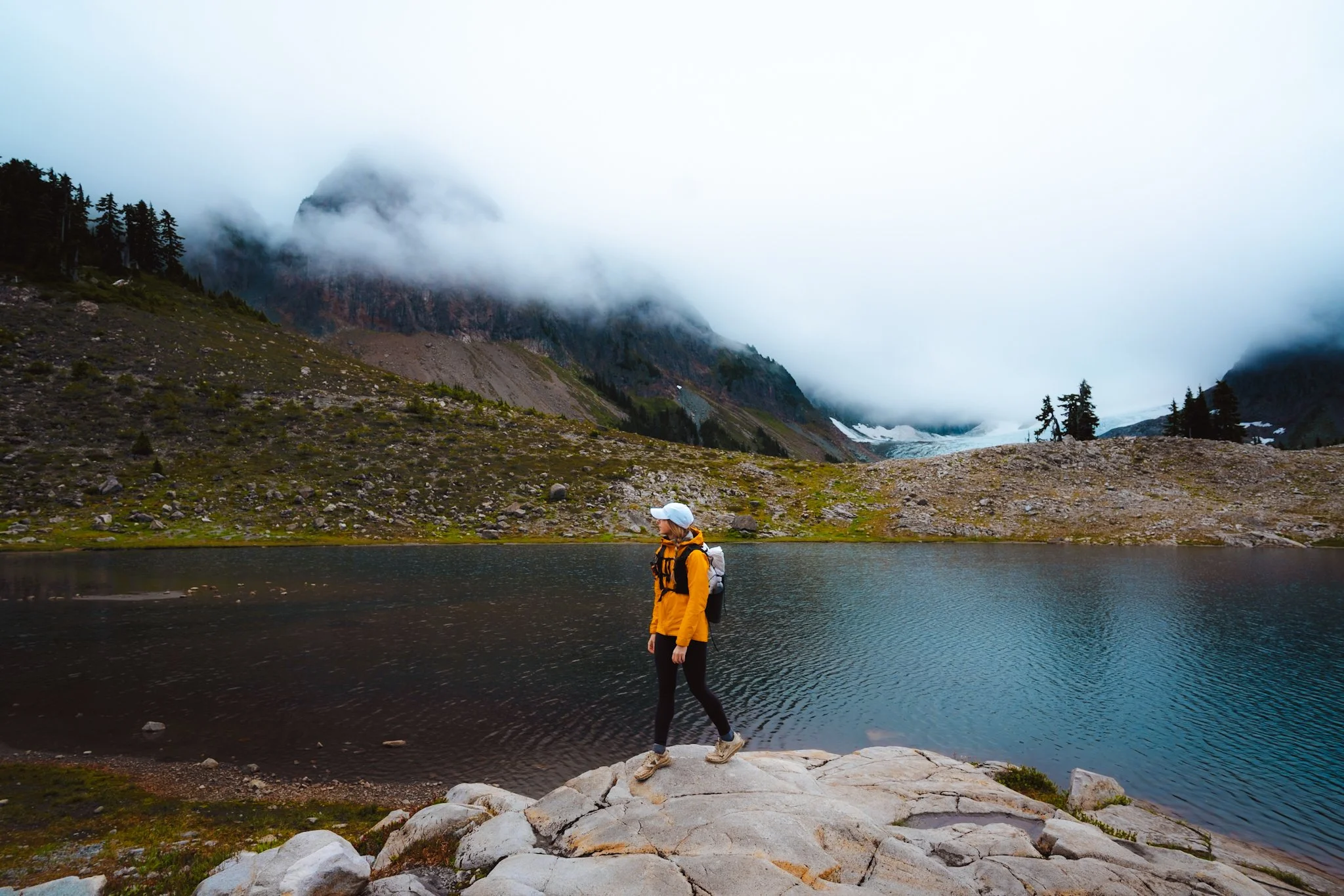
Lake Ann with the Lower Curtis Glacier in the background
Distance: 8.6 miles roundtrip
Difficulty: Hard
Elevation Gain: 2,150 ft
Best Time to Hike: Late July through mid-October. Snow usually melts out by late July.
Route Type: Out-and-back
Highest Point: 4,900 ft
Dogs Allowed? Yes, must be on a leash.
Permit/Parking Pass/Fee Required: Northwest Forest Pass or the America the Beautiful Interagency Pass
Trailhead/Parking: Lake Ann Trailhead
Trail Guide: AllTrails / Washington Trails Association
Road Condition: Paved all the way to the trailhead. 2x2 accessible.
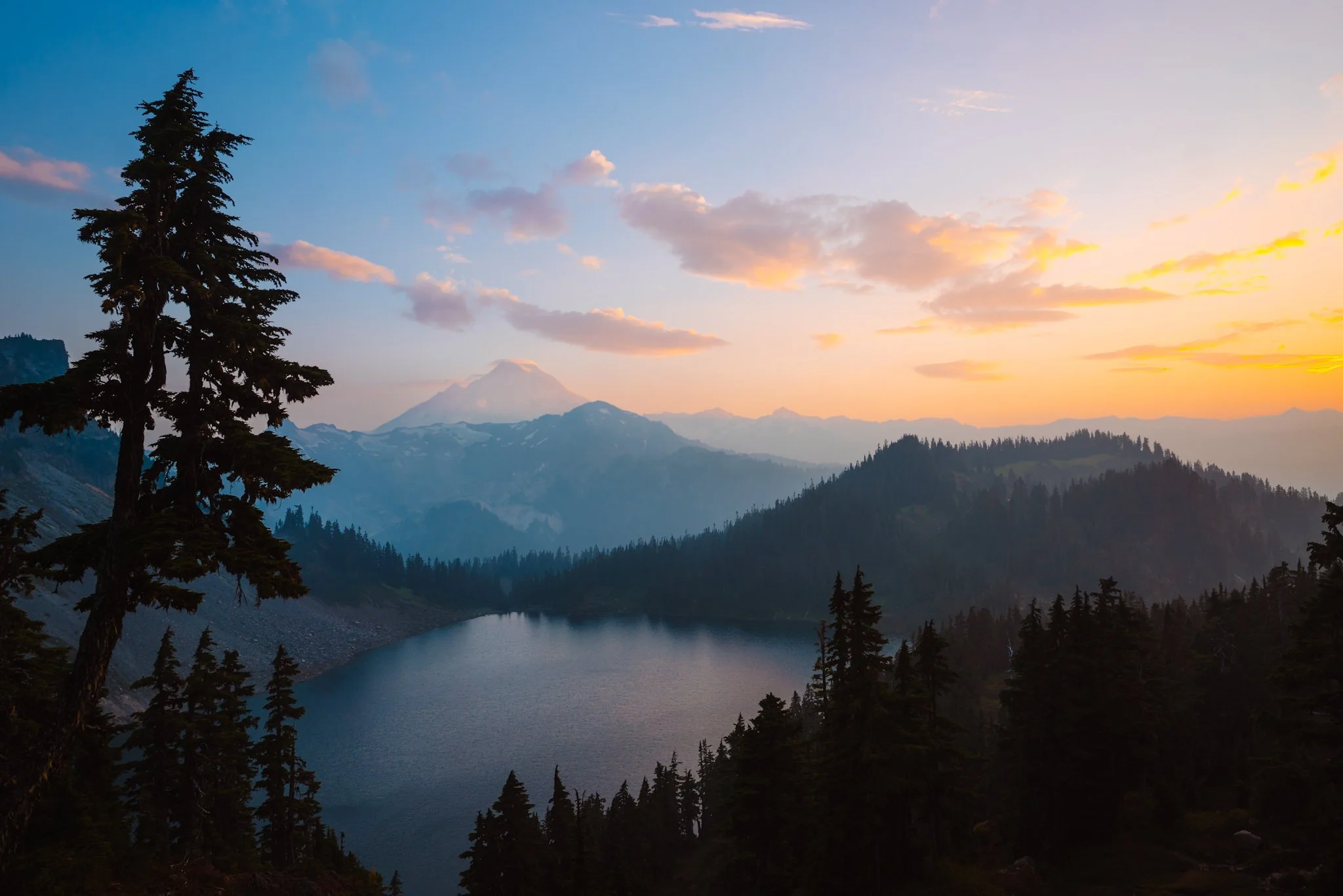
The Lake Ann trail leads you to a stunning alpine lake with Mount Shuksan rising above it and a view of the Lower Curtis Glacier. The last climb up to the basin is tough, but it’s definitely worth it!
Excelsior Pass
Distance: 8 miles roundtrip
Difficulty: Hard
Elevation Gain: 3,600 ft
Best Time to Hike: July through October. Snow usually melts out by end of July.
Route Type: Out-and-back
Highest Point: 5,400 ft
Dogs Allowed? Yes, must be on a leash.
Permit/Parking Pass/Fee Required: Northwest Forest Pass or the America the Beautiful Interagency Pass
Trailhead/Parking: Excelsior Pass Trailhead
Trail Guide: AllTrails / Washington Trails Association
Road Condition: Paved all the way to the trailhead. 2x2 accessible.
This trail is quite the workout and includes a lot of elevation gain, averaging about 900 feet per mile. But the views at the top of Mount Baker and the surrounding mountains are stunning.
Ptarmigan Ridge

Distance: 11.8 miles roundtrip
Difficulty: Hard
Elevation Gain: 2,400 ft
Best Time to Hike: Late July through October. Snow usually melts out by late July.
Route Type: Loop
Highest Point: 6,500 ft
Dogs Allowed? Yes, must be on a leash.
Permit/Parking Pass/Fee Required: Northwest Forest Pass or the America the Beautiful Interagency Pass
Trailhead/Parking: Ptarmigan Ridge Trailhead
Trail Guide: AllTrails / Washington Trails Association
Road Condition: Paved all the way to the trailhead. 2x2 accessible.
Ptarmigan Ridge is such a beautiful hike with nonstop views of Mount Baker. It’s rocky and exposed, but you can turn around at any point you want.
Yellow Aster Butte
Distance: 8 miles roundtrip
Difficulty: Hard
Elevation Gain: 2,800 ft
Best Time to Hike: Mid July through mid-October. Snow usually melts out by late July.
Route Type: Out-and-back
Highest Point: 6,150 ft
Dogs Allowed? Yes, must be on a leash.
Permit/Parking Pass/Fee Required: Northwest Forest Pass or the America the Beautiful Interagency Pass
Trailhead/Parking: Yellow Aster Butte Trailhead
Trail Guide: AllTrails / Washington Trails Association
Road Condition: The last several miles of road to this trailhead are pretty rough - it is a dirt road with tons of potholes.
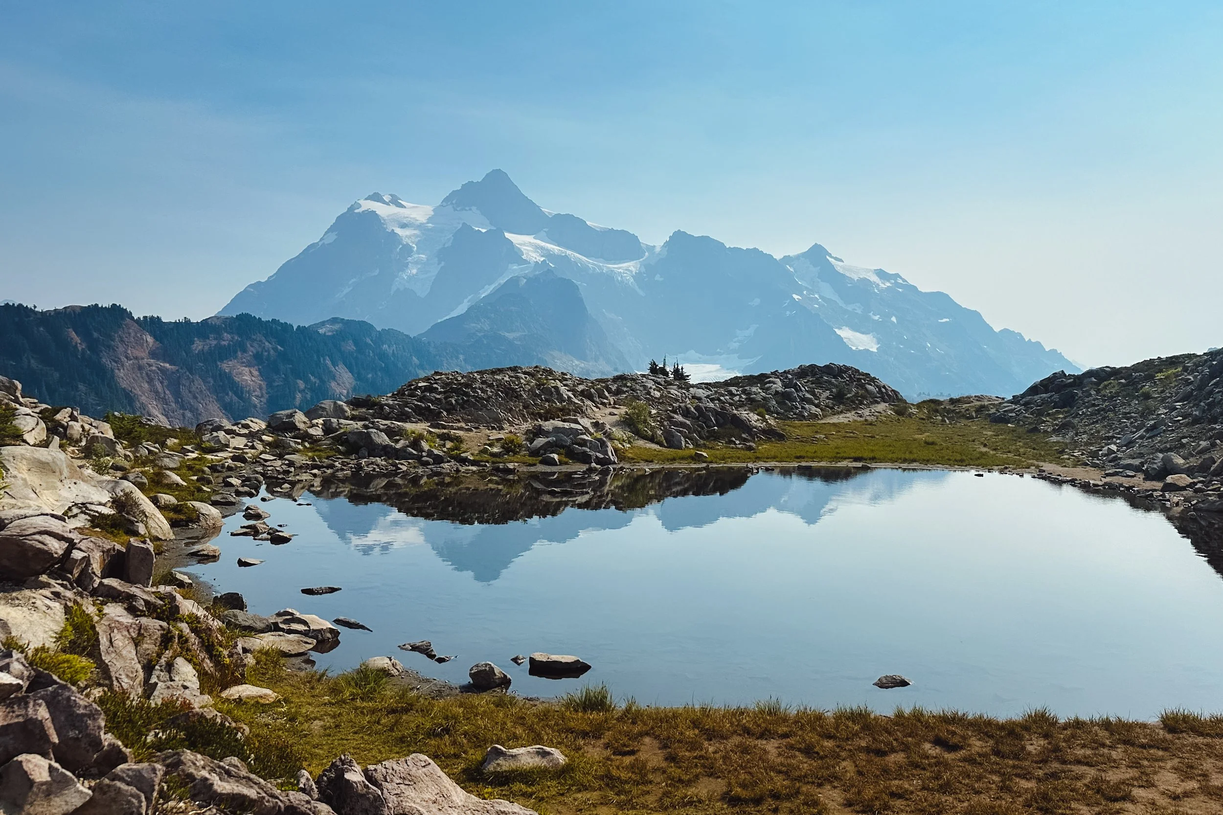
Yellow Aster Butte is another steep hike, but it’s incredibly beautiful. The views at the top of Mount Baker and Mount Shuksan are stunning. There are several different overlooks along the trail with views of the surrounding mountains and the small lakes pictured above.
Hannegan Peak
Distance: 10.7 miles roundtrip
Difficulty: Hard
Elevation Gain: 3,200 ft
Best Time to Hike: Mid/late July through October. Snow usually melts out by late July.
Route Type: Out-and-back
Highest Point: 6,200 ft
Dogs Allowed? Yes, must be on a leash.
Permit/Parking Pass/Fee Required: Northwest Forest Pass or the America the Beautiful Interagency Pass
Trailhead/Parking: Hannegan Trailhead
Trail Guide: AllTrails / Washington Trails Association
Road Condition: The final several miles of road to Hannegan Pass trailhead is a dirt road with a lot of potholes.
Hannegan Peak is a longer hike off Mount Baker Highway. The last couple of miles are pretty hard and very steep as you climb up to the peak. From the summit, you can see the surrounding mountains and a different perspective of Mount Shuksan.
This trail also provides a “back way” to hike into North Cascades National Park if you continue over Hannegan Pass toward Copper Ridge instead of heading up to Hannegan Peak - just remember, dogs are not allowed in the National Park!
Heliotrope Ridge
Distance: 5.5 miles roundtrip
Difficulty: Moderate/Hard
Elevation Gain: 1,850 ft
Best Time to Hike: Early July through October.
Route Type: Out-and-back
Highest Point: 5,300 ft
Dogs Allowed? Yes, must be on a leash.
Permit/Parking Pass/Fee Required: Northwest Forest Pass or the America the Beautiful Interagency Pass
Trailhead/Parking: Heliotrope Ridge Trailhead
Trail Guide: AllTrails / Washington Trails Association
Road Condition: The road up to this trailhead is rough - it is a single lane with turnouts for passing and has a lot of potholes.
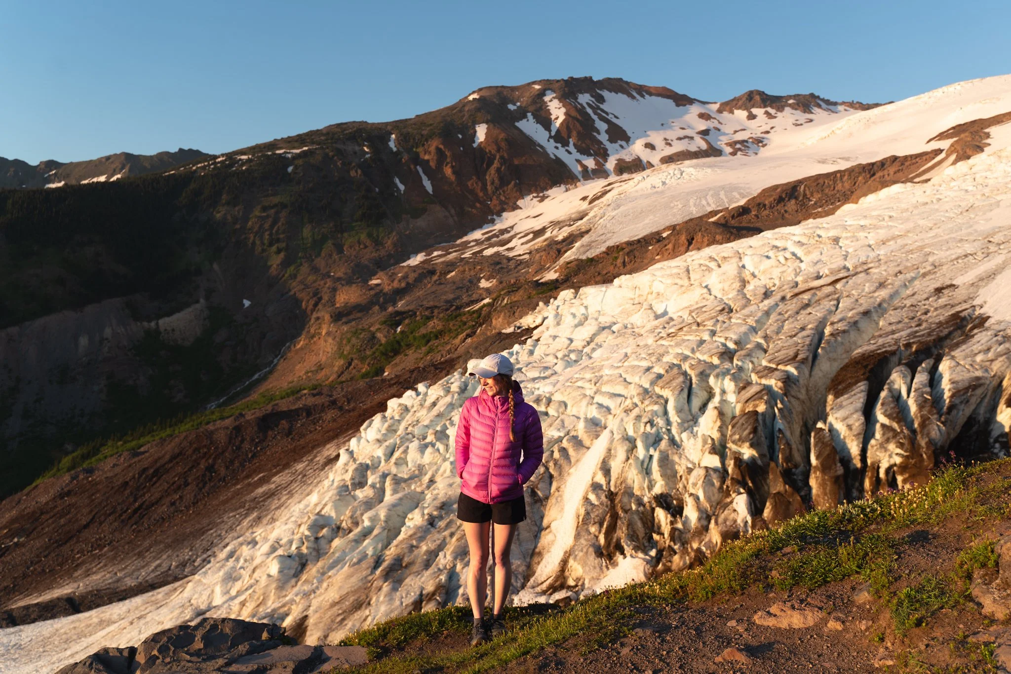
Heliotrope Ridge is stunning! On this hike, you can see Mount Baker and hike to the Coleman Glacier Overlook. The sounds of the glacier moving are truly incredible and humbling.
Important: On this trail, you’ll cross a couple of sketchy rivers, so make sure to bring trekking poles to maintain four points of contact while crossing. I also wouldn’t recommend bringing a dog, as the water crossings could be dangerous.
Read Next:


Save for later!


Let’s Connect: Instagram • TikTok • YouTube • Join My Newsletter | Enjoy This Post? Ways to Support this Blog